
Canada’s WildFireSat: A step forward in wildfire management
- September 25, 2023
- 11:09 am

Iain Hoey
Share this content
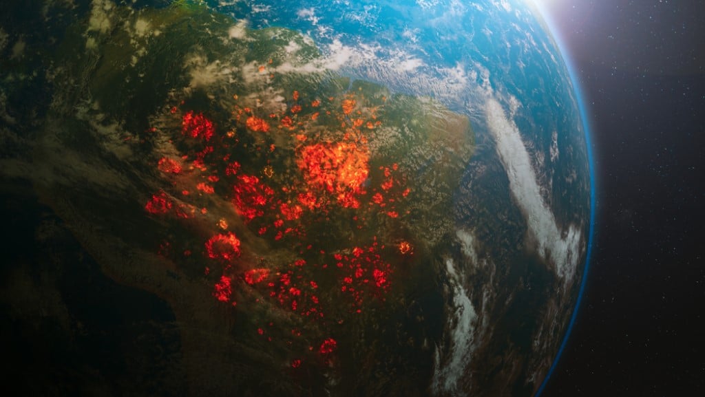
A novel approach to wildfire monitoring
Canada is launching an initiative, WildFireSat, to bolster its capabilities in monitoring active wildfires from space daily.
This advancement aims to optimise Canada’s response to wildfires, which remain a significant concern for the country.
Canada is characterised by its vast boreal forest, covering 88% of its 4 million km^2 forested lands.
Annually, approximately 7,500 wildfires consume over 2.5 million hectares, an area comparable to half the size of Nova Scotia.
The rising impact of climate change suggests that the forest area consumed by wildfires could double by 2050, emphasising the urgency for improved monitoring.
The economic and health implications of these wildfires cannot be understated.
Canada spends close to $1 billion annually on combating wildfires.
Yet, indirect costs, such as health-related expenses, property losses, and economic downturn in tourism and energy sectors, can escalate this number into the billions.
One example is the 2016 Fort McMurray wildfire, recording a staggering cost of around $9 billion.
Initiative details: WildFireSat’s mission
The WildFireSat mission, a collaboration between the Canadian Space Agency (CSA), Natural Resources Canada (NRCan), and Environment and Climate Change Canada (ECCC), will enable Canadians to obtain precise information on air quality and smoke conditions.
Furthermore, it will permit a more accurate measure of carbon emissions from these wildfires, aligning with international carbon reporting standards.
The Canadian technology offers a solution tailored to provide essential data for wildfire managers.
Given Canada’s expansive landscape, satellite observation remains the most effective method to monitor all active wildfires with the necessary precision.
WildFireSat promises to deliver comprehensive wildfire activity data at critical times of the day and to understand variations that transpire regionally and annually.
Benefits and potential of WildFireSat
The new system will undoubtedly benefit Canadians.
By enhancing wildfire monitoring precision, it will aid in decision-making, safeguard resources, and reduce health concerns tied to smoke and air pollution.
Furthermore, it emphasises Canada’s leading position in wildfire management research and its commitment to cutting-edge space technology deployment.
WildFireSat, using infrared sensors, will measure the energy emitted by wildfires, termed Fire Radiative Power (FRP).
This data will be pivotal in determining fire intensity, spread rate, and accurate carbon emission measurements.
When faced with multiple wildfires simultaneously, having a system like WildFireSat, combined with other pertinent information, will enable managers to prioritise and allocate resources effectively.
Improved smoke forecasting will also benefit air quality forecasting initiatives.
Scientific prospects and advancements
Dr. Josh Johnston, a forest fire research scientist and former firefighter, helms the WildFireSat mission.
His expertise lies in developing remote sensing tools for studying combustion and fire behaviour. Dr. Johnston’s collaborations with CSA since 2013 have paved the way for WildFireSat’s realisation.
Supporting research on wildfires, WildFireSat will fill the gap in current satellite observations, especially during the critical “peak burn period” in the late afternoon.
One distinguishing feature of WildFireSat is its use of a unique infrared sensor, which doesn’t require cooling.
By employing this innovative sensor, the satellite becomes more efficient, lightweight, and cost-effective.
As part of CSA’s commitment to transparency, all processed WildFireSat data will be available to the public upon release.
Looking ahead, the prospects of having multiple sensors in space would revolutionise wildfire observation frequency.
With WildFireSat’s advancements, such frequent monitoring becomes a feasible future.
IFSJ Comment
This initiative by Canada emphasises a global trend towards the integration of space technology in tackling terrestrial challenges. As wildfires become an increasing concern for numerous nations, the ability to monitor, predict, and manage these disasters is paramount.
WildFireSat’s potential to provide accurate, timely data offers a blueprint for future international efforts in wildfire management.
Its focus on cost-effectiveness and public data transparency sets an encouraging precedent for similar initiatives worldwide.